 6
64000 years old, mysterious history of Ireland, uncovered using Google maps
 13. 03. 2019


Crop Circles in Ireland? Yes, technically. But not the kind we associate with extraterrestrials. They look like the same type of circles, but it depends on how you look at them. In this as well as in other cases, google maps have allowed researchers to see our human (not extraterrestrial) past.
Anthony murphy
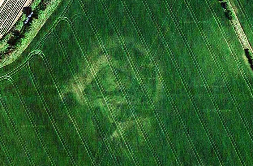
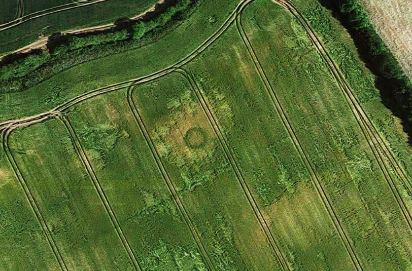
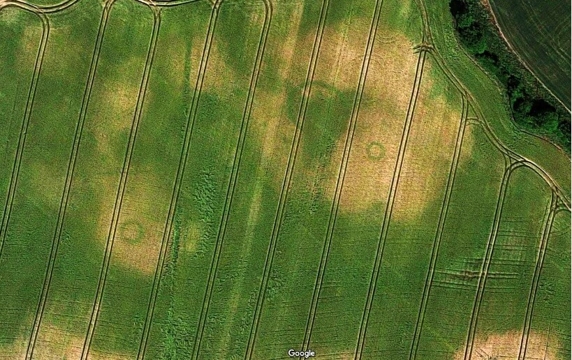
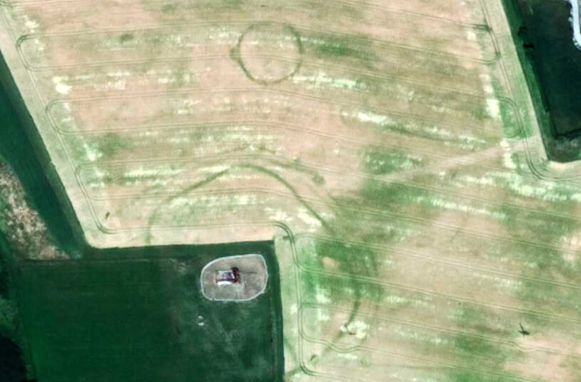
Anthony Murphy, founder of the Irish mythological group, looked at landscape images using google maps after a long drought in Ireland. What he discovered turned out to be an 50 year-old archaeological site that was previously unknown to researchers. The gallery of these images is below. According to Murphy, these finds were extremely hard to find because there were no traces of ancient monuments. It is possible that the people who have lived here for all these years have never realized that the land on which farms hide an ancient history.
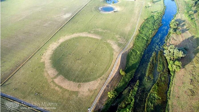
Some of these deposits, including circular fortifications and medieval buildings, date back to the Iron Age and some graves date back to the Bronze Age. All new excavations date from a few hundred years to 4000 years old and were found in Carlow, Dublin, Kildare and Meath. Some believe that some excavations are old to 6000 years. New deposits are mostly in size from 20 to 100 meter in diameter, while some excavations from earlier times are up to 3x larger.
Google Maps
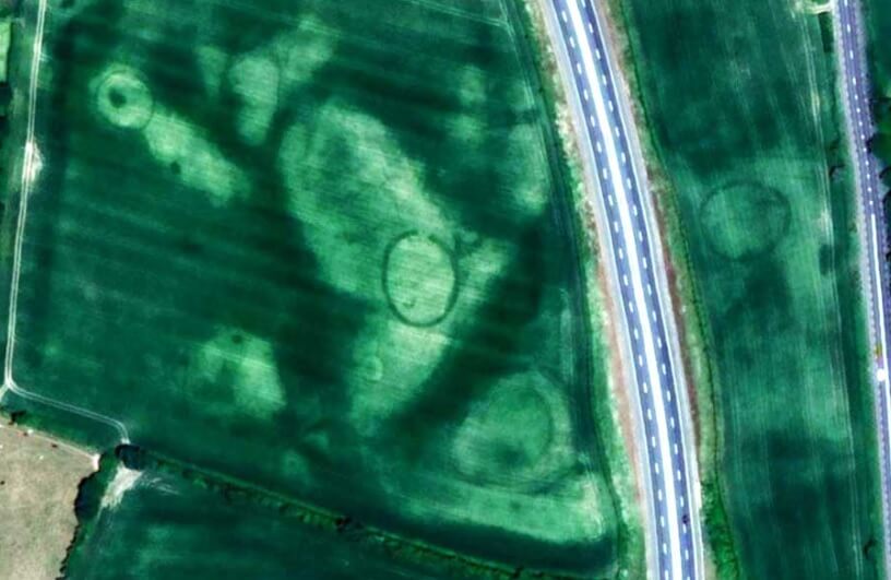
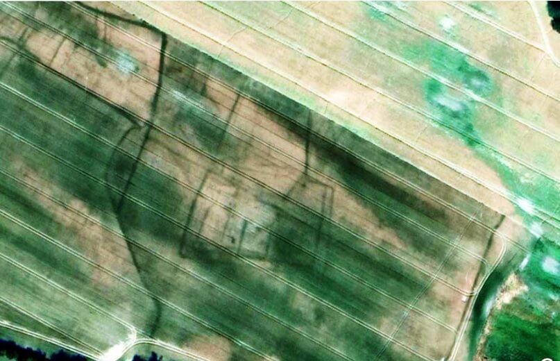
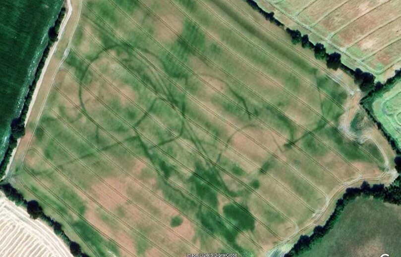
The team of scientists was very lucky with the timing of Google map imaging. Google regularly refreshes its aerial images, and if they were shot just a month earlier, the circles would never have been seen. After long droughts destroyed most of the cultivated fields in 2018, the excavations were more apparent. If the vegetation was healthy, the sites would never have been seen. But what about healthy vegetation
common with finding archaeological sites?
What Murphy replied: Because the soil at the site of the site retains more moisture, the crops thrive and grow greener than the surrounding flora. From the air, there is a visible contrast between healthy and less healthy greens, revealing shapes and structures underground. It's fascinating.
Archaeologically important sites
The weight of the stones used in the construction of these medieval structures caused their embedding into the ground, creating ditches. Thanks to these ditches, more water is retained here than in the surrounding soil. The grass that grows here stays healthy for a longer time and has a greener color. After examining patterns that were created by healthier greens, the group concluded that they were archaeologically important sites. According to Murphy, it was possible to discover the site this way in 1976 - the last time Ireland had experienced such drought.
Murphy has reported them to the National Archeology Office for further research. That was the second time in 2018 when Murphy made a similar discovery. He is also responsible for finding the previous undiscovered Neolith in Newgrange. Stone art as well as religious objects from prehistoric times were also found.
Minister of Culture and Heritage Joseph Madigan said:
“This new information is a graphical representation of the extent and density of ritual and ceremonial sites associated with the Newgrange Passage Tomb. This new stunning knowledge provides a remarkable insight into the origins and evolution of the Neolithic landscape and its society. ”