
 1
1Mars: Cydonia (skeptical view)
 01. 01. 2024


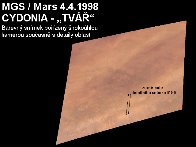
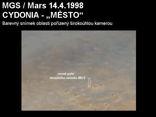
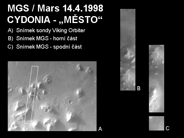
Above this text is a color image that was taken at the same time as a detailed picture with a wide-angle camera. The image is a red and blue image, the green color is calculated by averaging the red and blue images (as in the TV picture). Most of the northern hemisphere of Mars cover the winter clouds. Fortunately, the Cydonia area is relatively clean, although missing surface details indicate that the area can be shrouded in fog or mist.
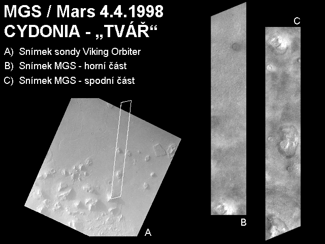
The second image [LEFT] contains the image of the Cydonia area taken by Viking on the left. This is the best resolution. All the details faces are just enlargements of this image. The picture of Viking is marked by an area covered by a detailed MGS image. It is split into two parts to the right. Face is located at the top (left - B) at the bottom and at the bottom (right - C) at the top.
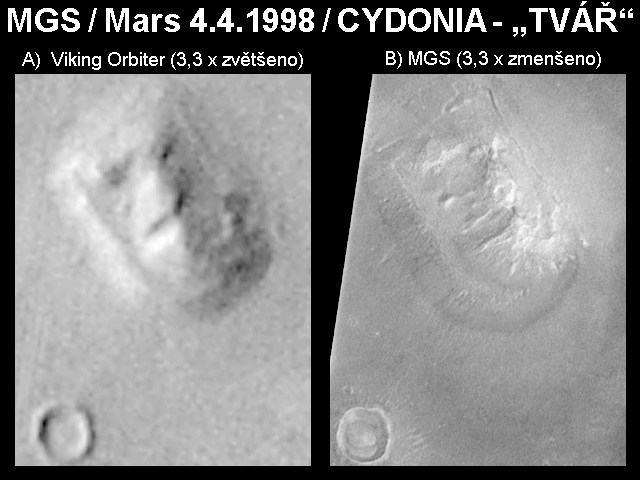
The third [RIGHT] image is a comparison of details faces. On the left is Viking Orbiter, on the right, MGS. The Viking Orbiter snapshot was 3,3 times reduced and the MGS 3,3 frame enlarged to have images faces the same scale. As you can see (and as all people with functional brains have assumed) face does not look much like face. [But the Ufis will surely say that it has been twinkling over the twenty years, or that it is the Potěmkin village of NASA, which created artificial images of the area to conceal the true ones. In this context, I would like to point out that, with the expected maximum resolution of MGS around 1,5 m / pixel, the two Martians carrying a pyramid of cement on a pyramid or water channel would be easily detectable. That's why NASA will need to create a complete Mars spare map to hide the right images. - note. JV].
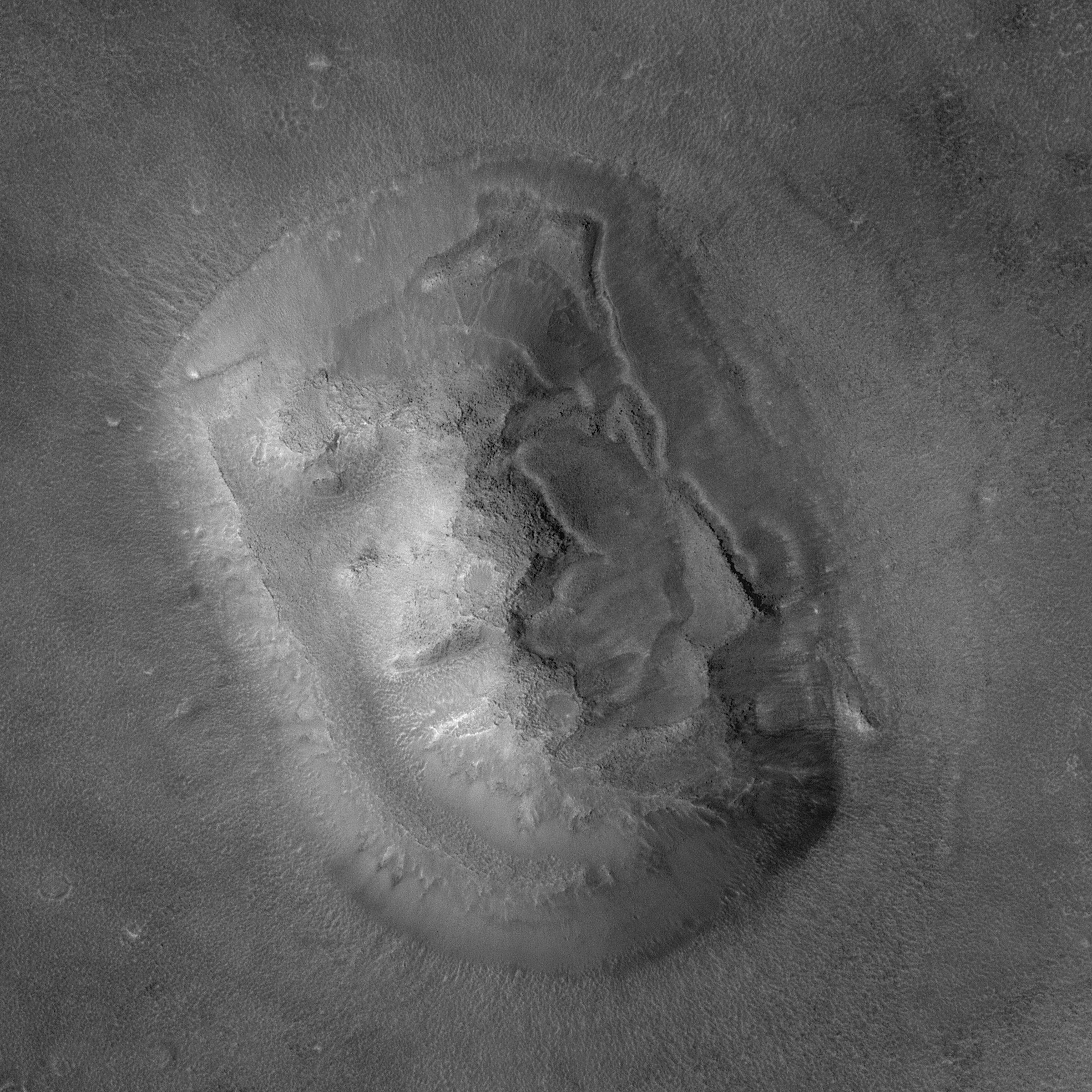
The words from the previous paragraph received confirmation. Because in 1998 she was in photography faces over the area of Cydonia fog, doubts arose. Therefore, it was in April 2001 face photographed again, this time in full resolution and in all its glory. It is a table mountain, of which we find many on Mars and on Earth. However, water erosion plays a very important role (at least on Earth) in the formation of table mountains. This makes the area of Cydonia undoubtedly very interesting.
You can view the image from April 8, 2001 in full resolution by clicking on the small variant below this text. The image shows an area measuring 3,6 km x 3,6 km with a resolution of 2 m. ATTENTION! The full resolution image is very large (2400 x 2400) and may take a long time to display.
Above this text is a color image that was taken at the same time as a detailed picture with a wide-angle camera. The image is a red and blue image, the green color is calculated by averaging the red and blue images (as in the TV picture). Surface details can be seen in the image - so much better conditions than when taking a picture faces ten days earlier. The white quadrant features a high-resolution area captured.
![]()
The second image [LEFT] contains the image of the Cydonia area taken by Viking on the left. The Viking picture shows the actual area covered by a detailed MGS image. It is split into two parts to the right.
The third image [FLASH RIGHT] shows the strip captured by MGS. The image has half the resolution from the original. There are many landslides, hills surrounded by ditches, intensely sprawling areas (resulting from differential erosion in different layers), and areas that reflect possible periglacial processes (ice movements and water saturated with soil and stones).
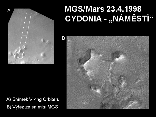
The picture below shows a Viking Orbiter image showing the area covered by MGS. On the right is the MGS snapshot just capturing square.